This major cyclone will voyage across an entire continent
A Category 4 cyclone is about to hit northeastern Australia, one of the strongest for the region.
It may still be 75 days until the start of the Atlantic hurricane season, but cyclone season has been well underway down under--having started Nov. 1, 2025.
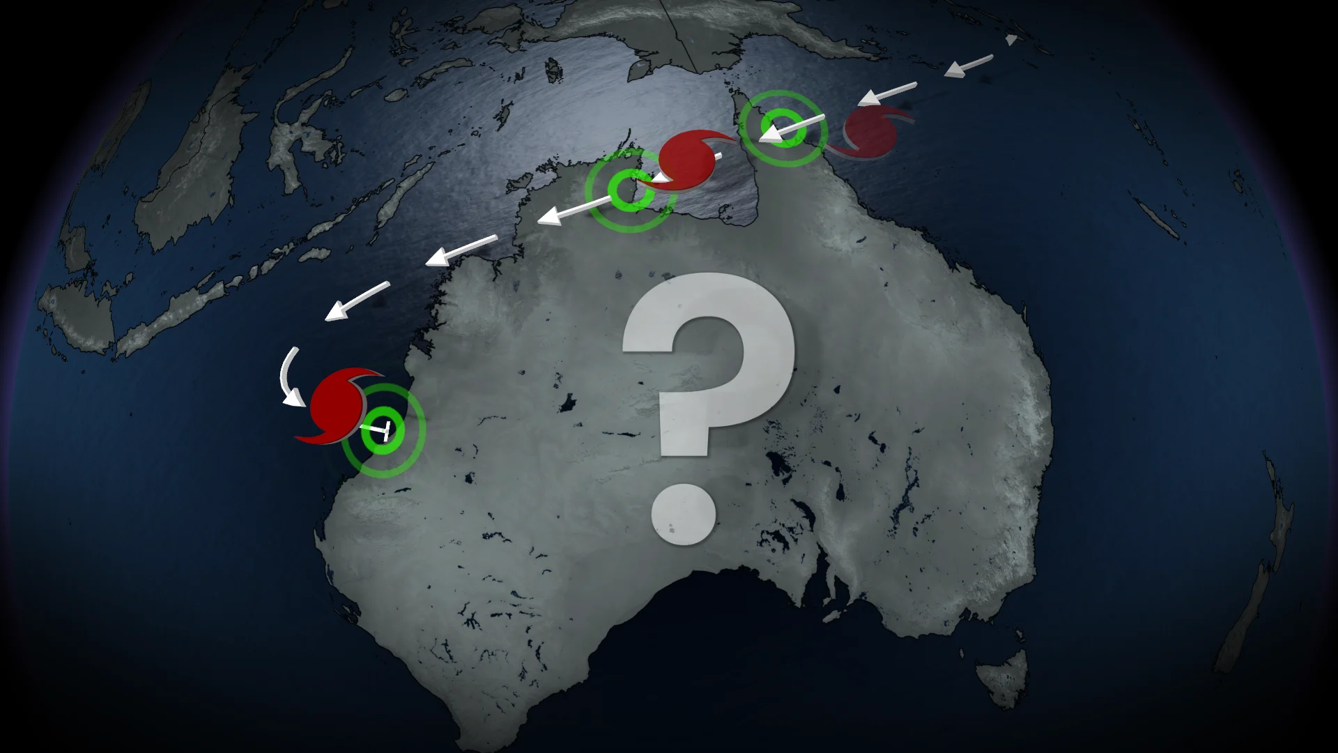
Australia's Bureau of Meteorology is warning of a major Category 4 cyclone, Narelle. Coming from the Coral Sea, Narelle is expected to journey more than 4,000 kilometres across northern Australia's coastline and into the Indian Ocean.
SEE ALSO: What does a hurricane's 'cone of uncertainty' mean?

Folks may notice in the forecast maps that the storm's path looks different than the ones we usually see during the Atlantic hurricane season. Australian cyclones are similar to Atlantic hurricanes in that their movements are dictated by global air circulation. In the Northern Hemisphere, we see storms move northeastward.
In the Southern Hemisphere, we see storms move in the opposite direction: Southwest. This is also why we often see cyclones that form in the Indian Ocean curve into Western Australia.
Narelle forecast to make landfall Friday
Narelle is forecast to make landfall in the far north of Queensland on Friday as a Category 3 or 4 storm. The major storm is a bit smaller in size, with its strong winds staying close to the eye, but it is also a fast-moving storm. These factors should help limit widespread flooding along the coast.
RELATED: What's the difference between hurricanes, typhoons, and cyclones?

The Australian Bureau of Meteorology has issued tropical cyclone warnings from Lockhart River to Cape Tribulation, as well as tropical cyclone watches for Cape Tribulation to Port Douglas, extending across the Central Peninsula to Weipa and Kowanyama.
"VERY DESTRUCTIVE WIND GUSTS in excess of 230 km/h are possible near the centre of Severe Tropical Cyclone Narelle as it crosses the coast," the bureau warned on Wednesday.
After tracking west through Queensland and recouping over the Gulf of Carpentaria, Narelle is forecast to make a second landfall in the Northern Territory at Category 3 strength over the weekend.
Rare, triple landfall possible

Long-range models are still uncertain about Narelle's storm track beyond the weekend, but it is possible we could see the storm make a rare, third landfall over Western Australia.
The last time we saw a tropical cyclone make a triple landfall in Australia's mainland was 21 years ago, in 2005, with Cyclone Ingrid!