Tornado scar visible from space after major severe weather outbreak

A multi-day severe weather outbreak has left dozens dead and significant damage from Texas to Vermont
A significant, days-long severe weather outbreak across the United States has caused widespread damage and multiple fatalities—and the storms aren’t over yet.
One violent tornado struck the heart of St. Louis, Missouri, on Friday, killing at least five people as it levelled homes and businesses in the city.
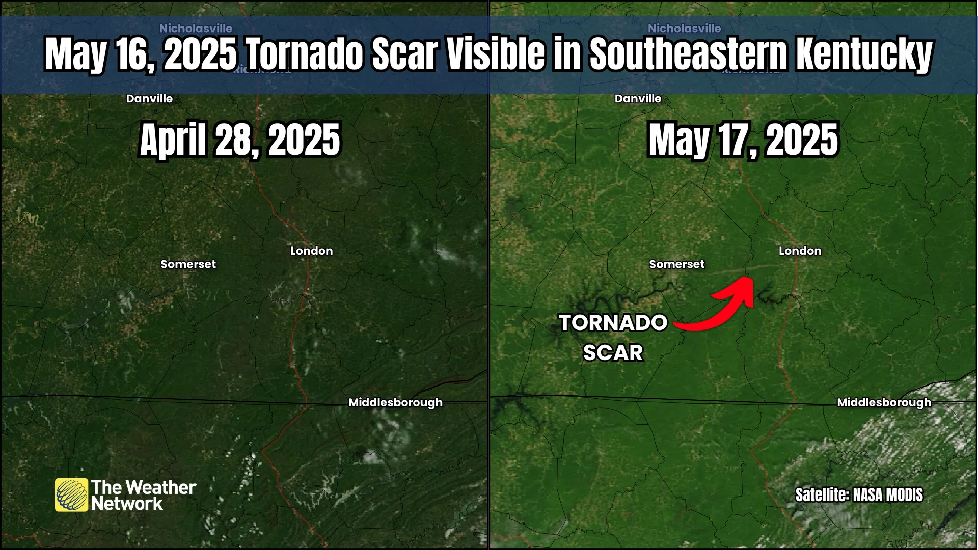
Another particularly intense tornado in southern Kentucky produced so much destruction that it left behind a scar visible from space.
DON’T MISS: The frightening reason violent EF-5 tornadoes are so rare
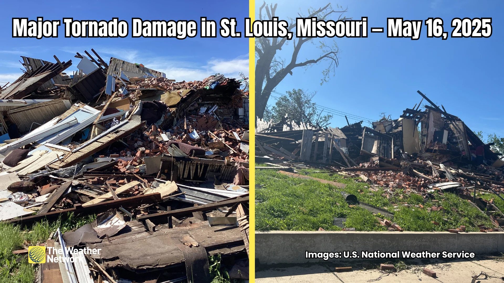
Officials confirmed Sunday that the tornado that struck St. Louis, Missouri, was an EF-3 with estimated winds of around 240 km/h. The storm killed five people and reportedly damaged more than 5,000 buildings.
Another long-track supercell that travelled hundreds of kilometres from Missouri to Kentucky produced a powerful and devastating twister as it moved through the southern Kentucky communities of Somerset and London.
MUST SEE: Don’t fall victim to these seven dangerous tornado myths
Staffing issues at local U.S. National Weather Service offices will prevent meteorologists from formally assessing the damage for several more days. But imagery from the ground revealed extensive damage to homes and businesses, some nearly swept from their foundations. Local news station WLKY reported Monday that the Kentucky tornado killed at least 19 people.
The storm in southern Kentucky produced such a long and wide damage track that it left behind a scar easily visible from space. Before and after images from NASA’s MODIS show a distinct clearing between Somerset and London where the tornado destroyed trees and buildings along its path.
RELATED: How severe weather alerts are issued, and potentially save lives
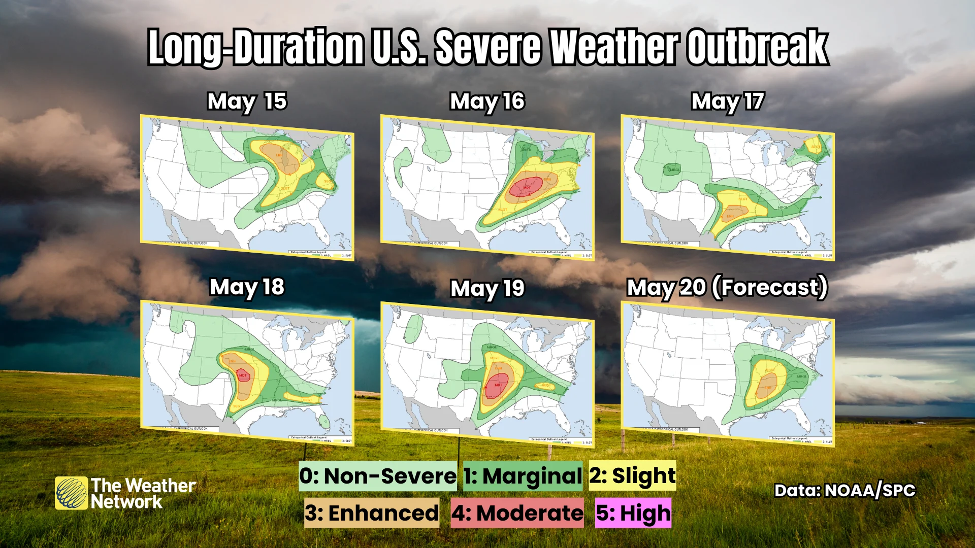
These destructive storms occurred as part of a long-duration severe weather outbreak affecting the eastern half of the United States. Forecasters issued an ‘enhanced’ level three out of five severe weather outlook every day between May 15 and May 20, with three of the days featuring a 'moderate' level four out of five risk for severe thunderstorms.
The U.S. Storm Prediction Center (SPC) received nearly 2,500 reports of severe weather—including tornadoes, wind damage, and hail the size or quarters or larger—across the country between May 15 and May 19. Spotters relayed numerous reports of hail measuring 10 cm in diameter or larger, including one 11.4 cm diameter hailstone near Arnett, Oklahoma. For reference, that's larger than the average grapefruit.
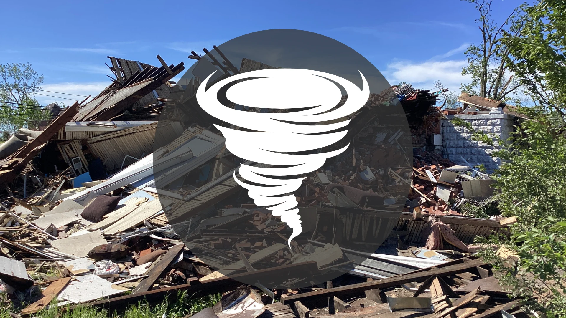
Header image created using imagery from Canva and the U.S. National Weather Service.