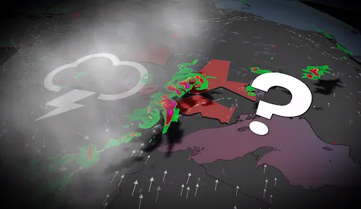
When smoke meets a storm, Ontario gets unique weather Monday

Ontarians could see both lightning and hazy skies during the week ahead
Wildfire smoke and thunderstorms are set to clash in Ontario this week, as an approaching cold front brings more than just stormy weather.
The powerful cold front is set to slice through northwestern Ontario on Monday, acting as the main trigger for a week of unsettled weather.
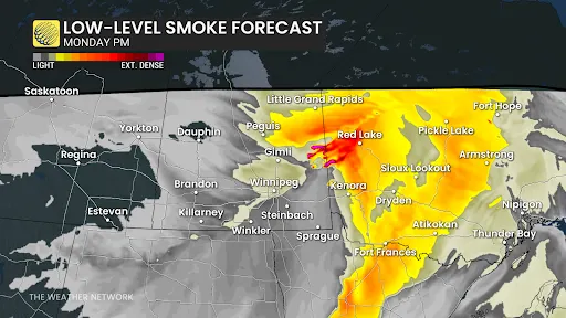
The ongoing wildfires in Western Canada have produce smoke that will flow westerly as the front advances. This means parts of Ontario could be experiencing both lightning displays and hazy, smoke-filled skies simultaneously.
DON'T MISS: The Weather Network's wildfire hub
Wildfire smoke may suppress severity of storms
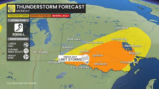
For northwestern Ontario, Monday will kick off with temperatures nearing a 30°C, but dense pockets of wildfire smoke might actually act as a natural suppressant for some of the instability, potentially limiting the severity of active weather.
There's still a slight risk of supercells developing early Monday evening. Storms are more likely to cluster into messy lines, providing heavy downpours, frequent lightning and gusty wind possibly exceeding 90 km/h in the strongest cells.
By Tuesday, the risk of storms spreads into northeastern Ontario, and by Wednesday pockets of southern Ontario will need to keep a watchful eye out for thunderstorm activity.
While the presence of wildfire smoke does introduce some uncertainty by potentially dampening storm intensity, the cold front itself is a strong and clearly defined trigger. We could see temperatures plummet by over 10°C in just an hour or two on Monday evening as the front sweeps through.
Continue to follow The Weather Network for the latest weather updates across Ontario.