Canada, where did all the fall storms go?

Classic fall storms will remain noticeably absent across much of Canada heading through the remainder of October
While there have been some weather hiccups in October across Canada, one commonality is the lack of fall storms.
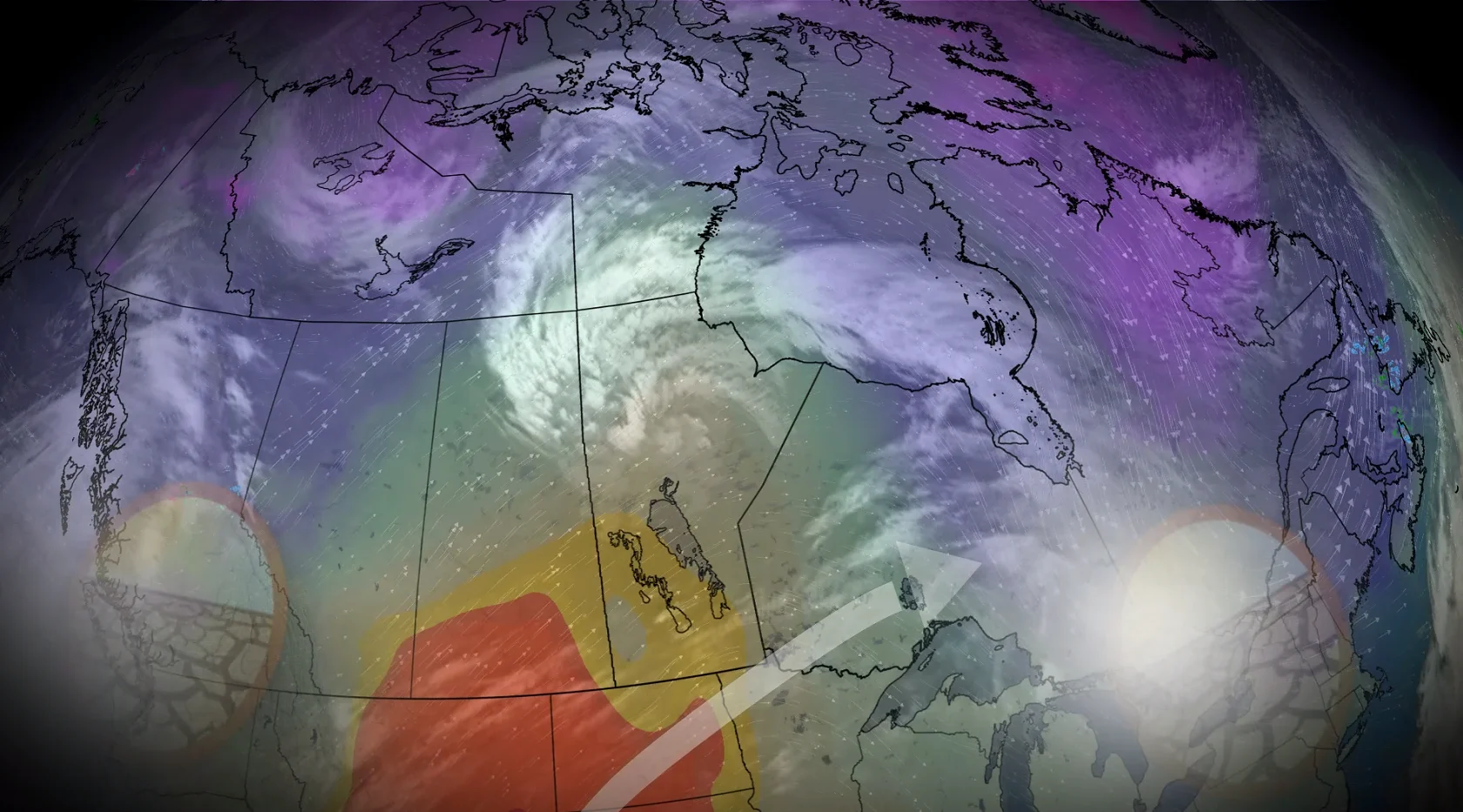
The month has brought a very different flavour to parts of the country, compared to September's weather. October started with summer-like warmth in Ontario and Quebec, while the West endured some chilly temperatures. That pattern has since flipped.
But there haven't been many of your typical fall storms this season, making for a super-dry pattern in many areas in Canada. Let’s dive into why the storms are absent so far.
DON'T MISS: What does a classic fall storm look like in your part of Canada?
What fuels fall storms?
A split flow, in which the jet stream literally splits in two, will prove a prominent feature during the second half of October, promoting a less-consolidated jet stream that would otherwise impact the coast of British Columbia throughout autumn.
Some of that energy is being redirected down toward California, a change that’s significantly affecting our weather patterns across Canada.
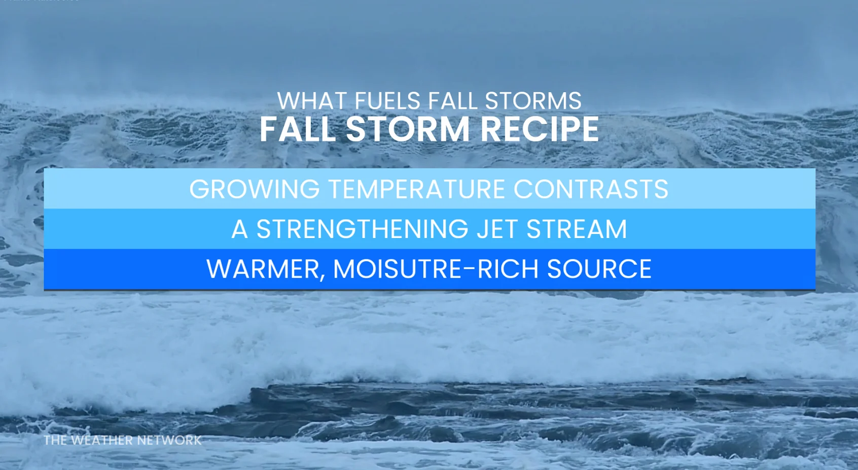
Growing temperature contrasts, a strengthening jet stream, and warmer, moisture-rich air are the ingredients that promote the development of classic fall storms across the country.
Those main ingredients are notably absent over the next seven to ten days.
Western Canada
B.C. will face a stunning precipitation deficit through the remainder of October, with 100-150 mm of ‘missing’ precipitation in the forecast. Why?
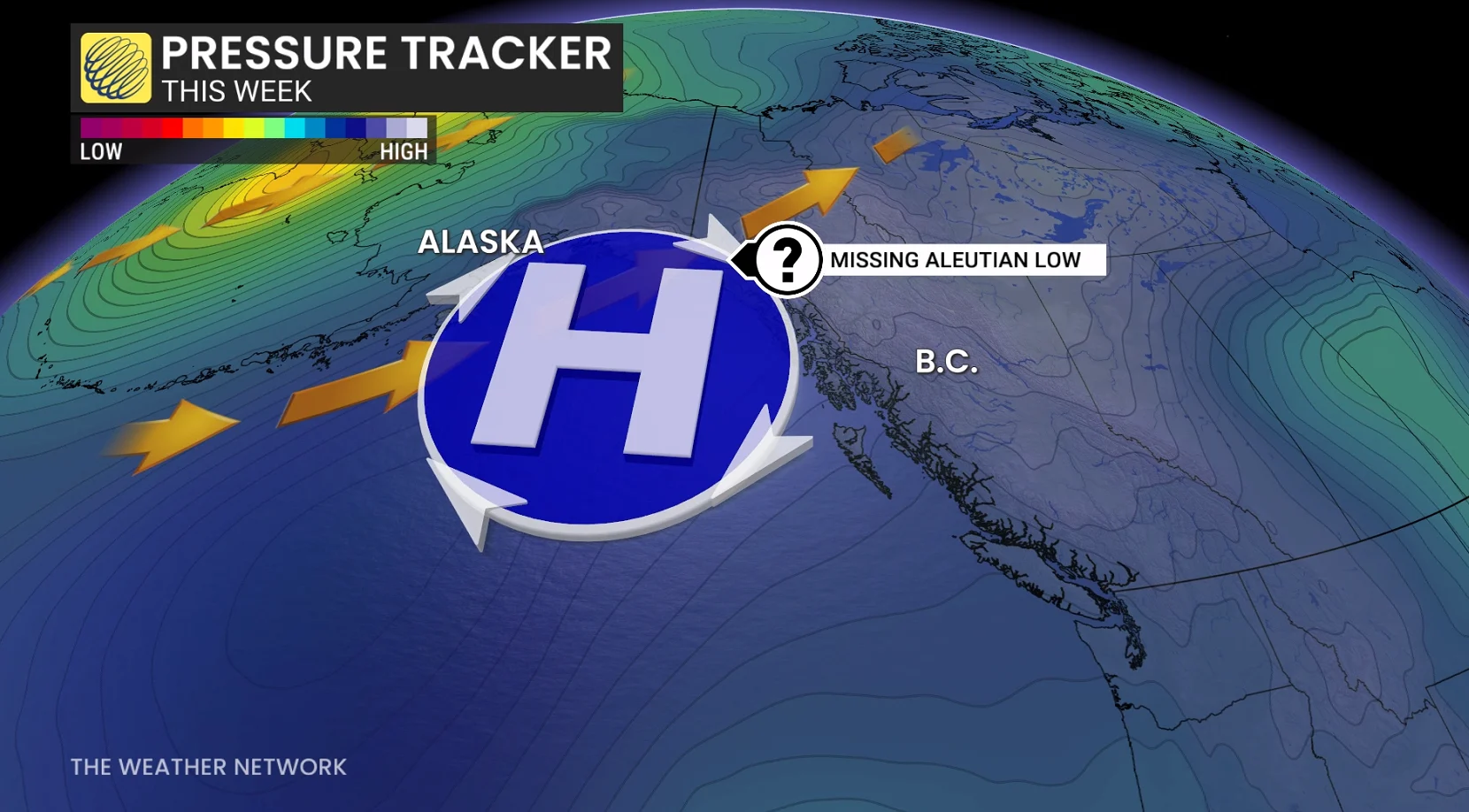
A ridge in the northeastern Pacific is taking the place of the usual Aleutian low that begins to establish itself by mid-fall. The low-pressure signal has been displaced much farther south toward California, where the strongest signal for wet weather exists.
As a result of this pattern, temperatures will even tip below-seasonal at times through the end of the month.
Farther east, the Prairies are the only region of the country without a strong dry signal to finish off October. In fact, conditions look more like September across the eastern Prairies.
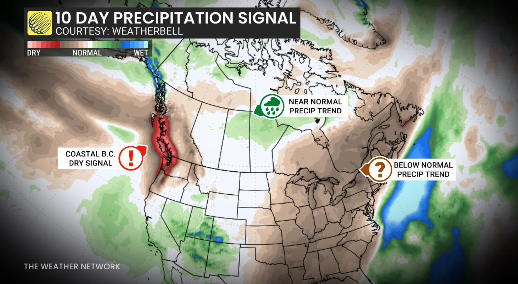
Precipitation here is forecast to come in near- or above-normal for the central and southern parts of the Prairies as energy affecting California moves across the region.
Troughs moving across the Rockies will naturally want to create surface lows over the Prairies; in an unusual twist, this will be one of Canada’s only primary storm tracks to round out the month.
Eastern Canada
These low-pressure systems will contain influxes of mild air that will carry across Central Canada, spilling into Ontario at times.
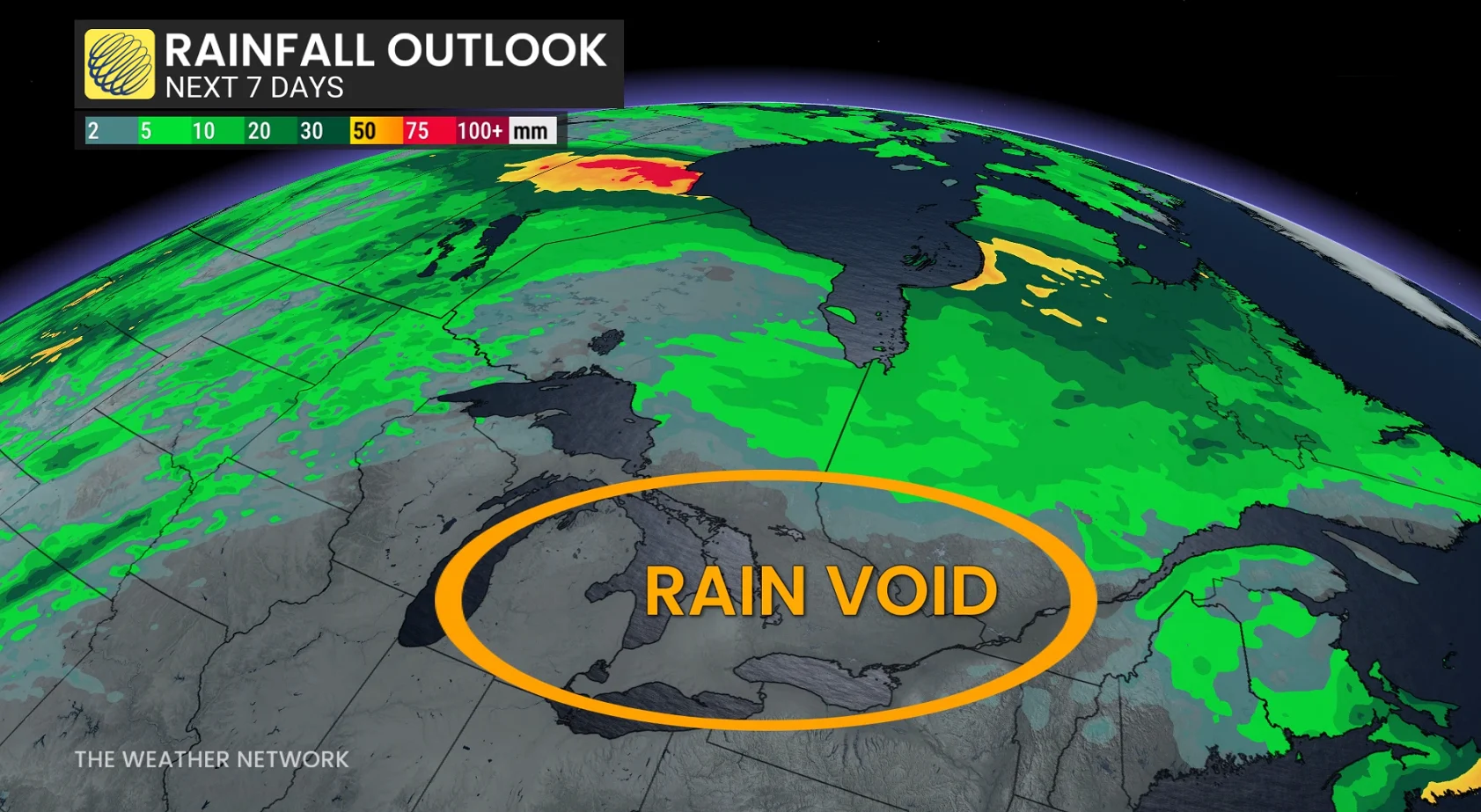
Folks across Ontario and southern Quebec have won the fall lottery through the end of October.
A persistent signal in the atmosphere will allow ridges of high pressure to extend from the Gulf of Mexico to northern Quebec, acting as a storm shield. Such a pattern will deflect storms away from the East Coast, along with keeping the Prairie storms aimed toward Hudson Bay.
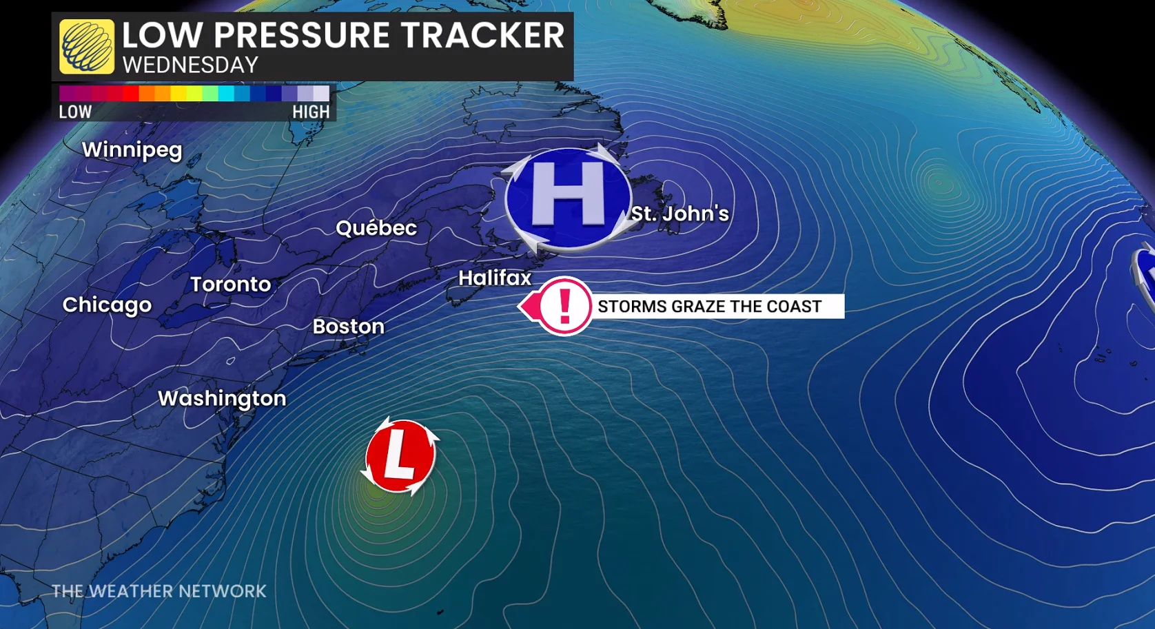
This setup will lead to a close call for Atlantic Canada. The blocking pattern will generally keep the region storm-free, but it’s a matter of kilometres as offshore lows just grazing the coastline. These systems aren’t expected to push very far inland at all.
The East Coast won’t be basking in summer-like warmth anytime soon, as the region of high pressure and an occasional trough allow some cooler air to remain parked across the region.