A super typhoon may determine Canada’s late-October pattern

The track Champi takes may determine Canada’s Halloween weather patterns this year
Canada’s forecast this Halloween may come down to a growing typhoon half a world away.
Champi is expected to grow into a super typhoon by next week as it passes through the western Pacific basin.
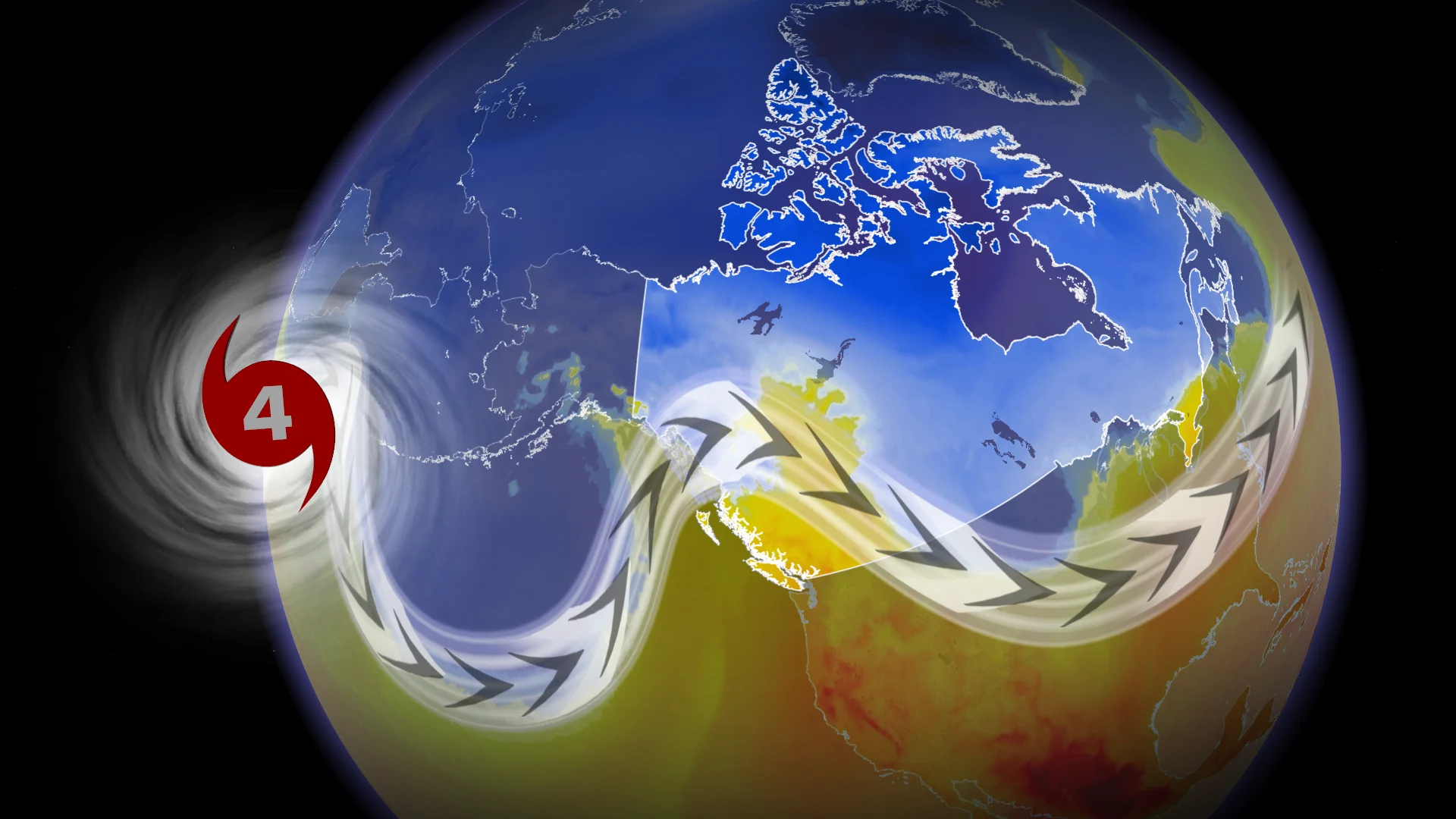
One scenario holds the potential that the typhoon will recurve and influence the pattern over Canada, potentially sending chilly air swooping south toward some areas.
DON’T MISS: Winter has a few tricks up its sleeve for Eastern Canada this year
A budding tropical storm about 1,200 km east of Guam will grow into Typhoon Champi heading into this weekend.
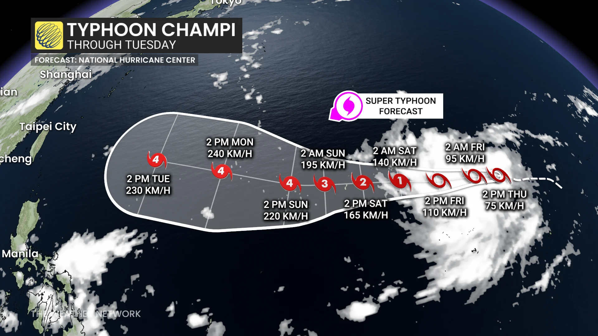
Forecasters expect the system to bring dangerous winds and rain to Guam and the Northern Mariana Islands this weekend as it moves west and quickly intensifies.
The system should reach the equivalent of a major hurricane by Saturday or Sunday, and it may achieve super typhoon status with winds of 240+ km/h by early next week.
Recurving typhoons can have a significant impact on downstream weather patterns over Canada.
As of now, the forecast looking toward the end of the month calls for dry and mild conditions over Central Canada as a ridge of high pressure dominates the region, alongside unsettled conditions on the eastern and western coasts.
There’s a chance this may change as a result of the typhoon’s track.
First scenario is less impactful
A complex steering pattern over the western Pacific will determine where Champi ultimately travels.
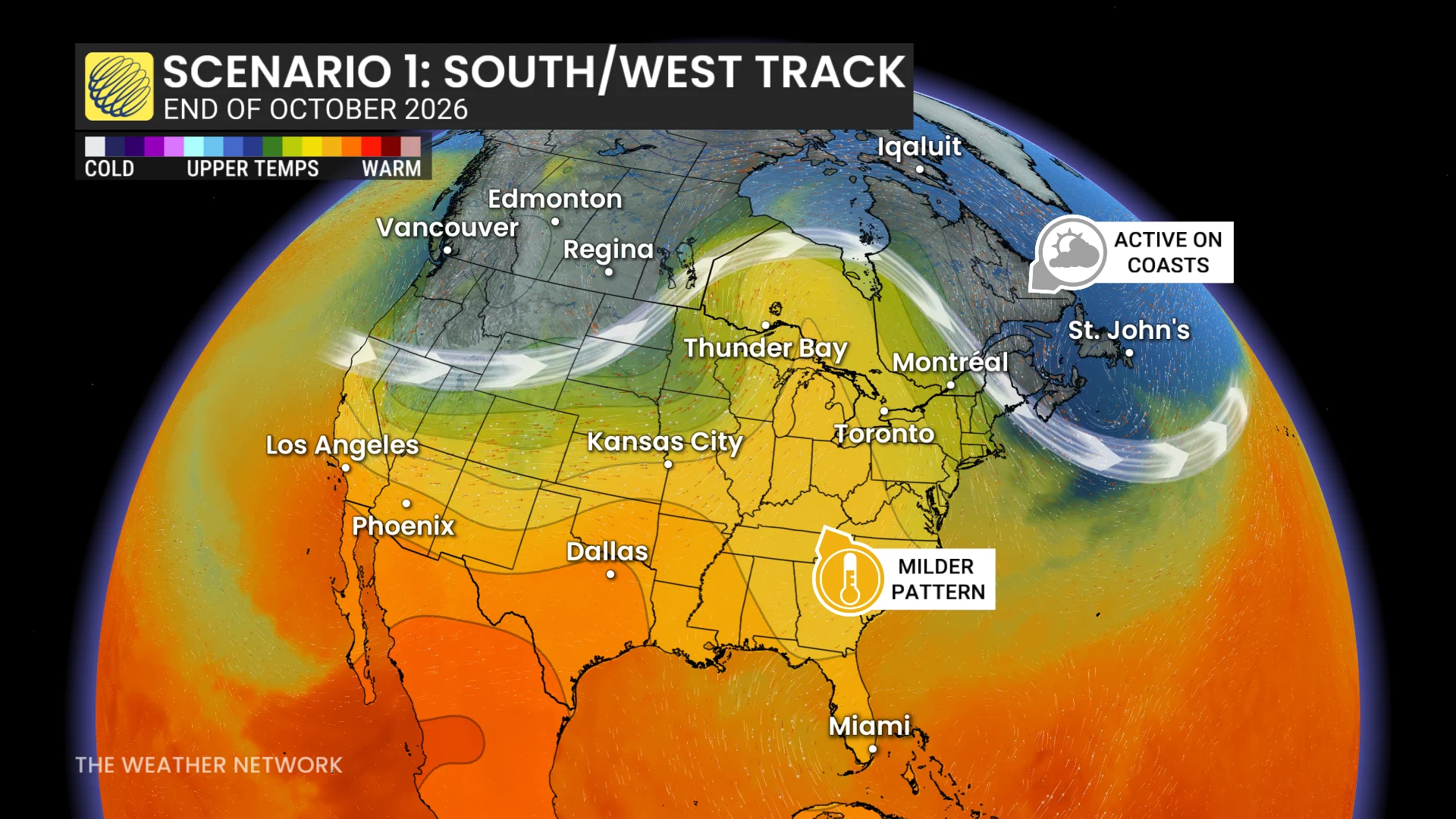
One scenario holds the potential for a track that stays farther south and west, bringing significant impacts to portions of Taiwan and mainland China.
Such a track would reinforce the mild pattern already expected to be in place over Ontario and Quebec as we get closer to Halloween.
Second scenario sees big changes for Canada
The chance exists for this storm to turn north and east, instead, following a track that recurves over the northern Pacific Ocean.
Some uncertainty exists about when this would play out. If the recurve happens earlier in the storm’s lifecycle, this would act to disrupt the pattern over Canada.
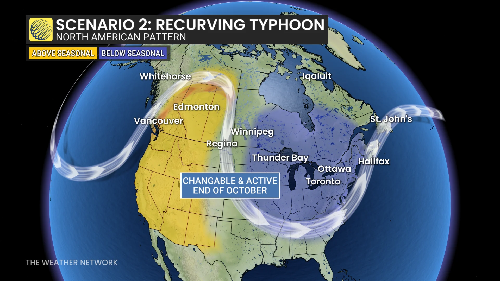
A more amplified jet stream pattern would disrupt the expected ridge over the eastern half of the country, creating the potential for an active pattern that would prove chillier and more changeable.
Experts will closely monitor Champi in the coming days to better nail down its future path, as well as any potential downstream impacts on Canada’s weather heading into the latter half of October.
Stay with The Weather Network for all the latest on conditions across the country.