Rare tornadic setup covers desert cities again on Thursday

Another rare severe weather setup covers portions of the U.S. Southwest on Thursday, including the city of Phoenix
An unusually potent threat for severe weather covers portions of the U.S. Southwest again on Thursday, bringing a second day of severe storms to the region.
Thursday’s severe weather risk is a continuation of the same setup that brought the region multiple reports of rotation and hail the size of golf balls and larger on Wednesday.
DON’T MISS: Canada records its northernmost tornado in nearly 50 years
The atmospheric setup over this desert region is more akin to what you’d expect to see on the Plains or the Prairies.
An upper-level trough swinging across California brought the lift needed to spark thunderstorms amid enhanced instability and moisture.
Strong wind shear aloft has allowed thunderstorms to turn severe, with some organizing into supercells capable of producing very large hail, damaging wind gusts, and tornadoes.
Wednesday’s storms prompted widespread severe thunderstorm and tornado warnings across Arizona and Utah. Storm chasers reported several potential tornadoes in the region, and one report came in of hail up to 5 cm (2 in.) in diameter northwest of Phoenix.
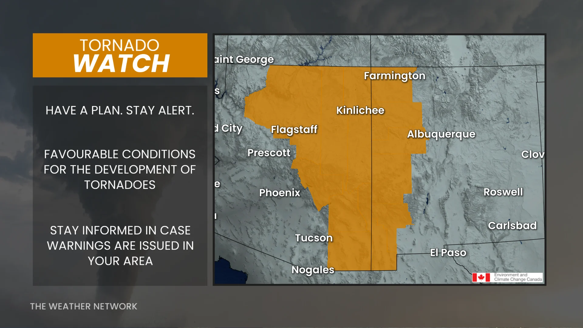
A similar setup on Thursday prompted the U.S. Storm Prediction Center (SPC) to issue another rare tornado watch across eastern Arizona and western New Mexico. Additionally, a severe thunderstorm watch covers the Phoenix metro area.
Alongside the threat for tornadoes, Thursday’s storms could produce very large hail up to 5 cm (2 in.), as well as wind gusts up to 110 km/h.
It’s rare, but not unprecedented, for the desert Southwest to face such a potent threat for severe weather.
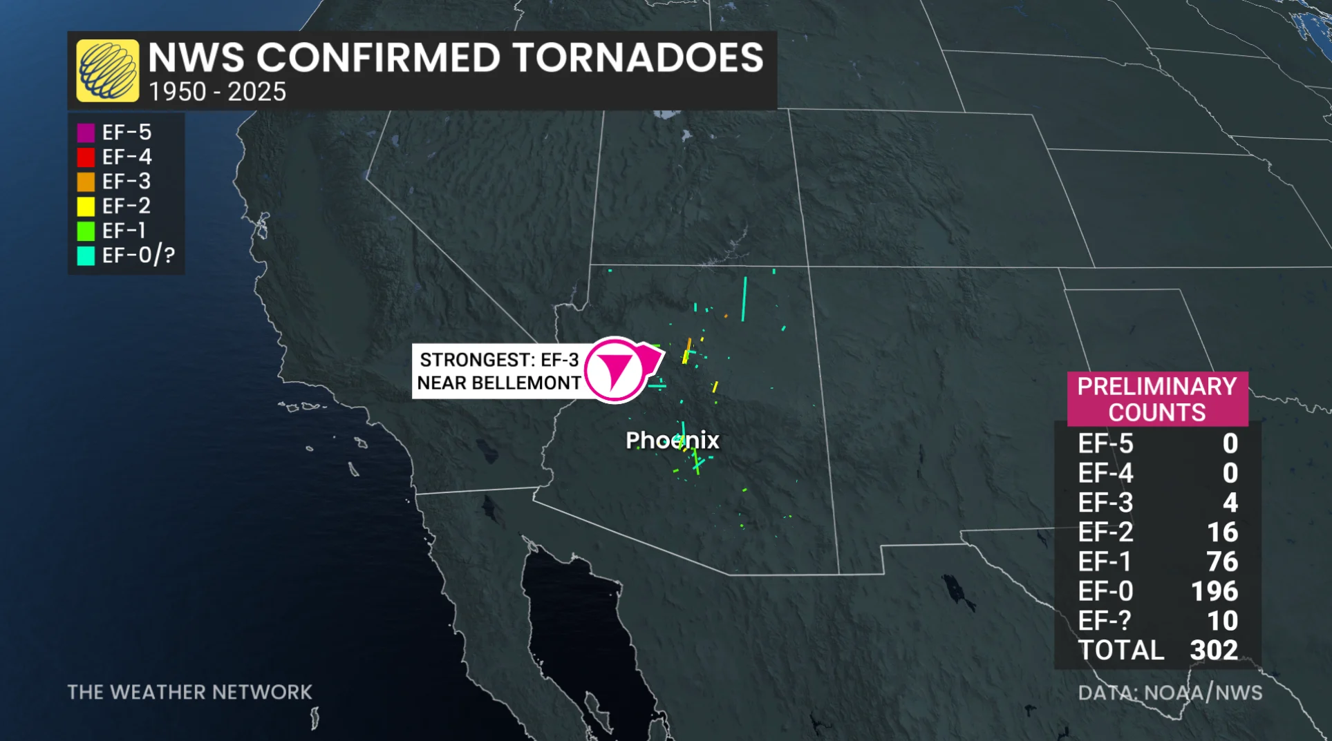
The SPC documented 302 confirmed tornadoes in Arizona between 1950 and 2025. Most of Arizona’s documented tornadoes occurred between July and September.
A favourable setup in early Oct. 2010 produced an EF-3 tornado near the city of Flagstaff, which remains one of the state’s most powerful twisters on record.
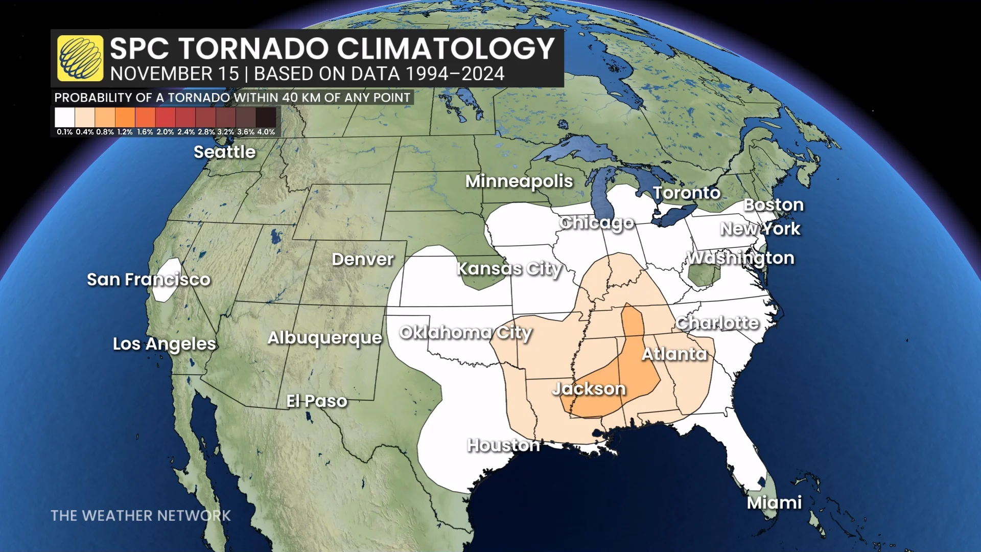
The autumn months typically feature an uptick in severe weather across the southern United States as powerful fall storms sweep toward the Great Lakes.
In fact, the late fall and winter months are considered a ‘secondary’ tornado season for portions of the Deep South.