Rotating storms: Prime severe weather setup in Manitoba, northwestern Ontario

Multiple rounds of severe storms will target southern Manitoba and northwestern Ontario on Monday, with the risk of rotation for some locales
The long weekend could have a disruptive, stormy end in parts of Manitoba and northwestern Ontario.
The biggest concern extends from southeastern Manitoba to northwestern Ontario where severe storms will be possible through Monday overnight. A tornado can't be ruled out as rotating storms will be possible for some areas.
Please keep up with the latest watches and warnings in your area. Take immediate action if a tornado warning is issued for your location.
Conditions favourable for severe weather on Monday
A cold front is expected to trigger thunderstorms across extreme southeastern Manitoba and northwestern Ontario on Monday.
In fact, multiple rounds of thunderstorms are expected throughout the day in the aforementioned regions, particularly from the Lake of the Woods region through Kenora, and from Dryden to Fort Frances.
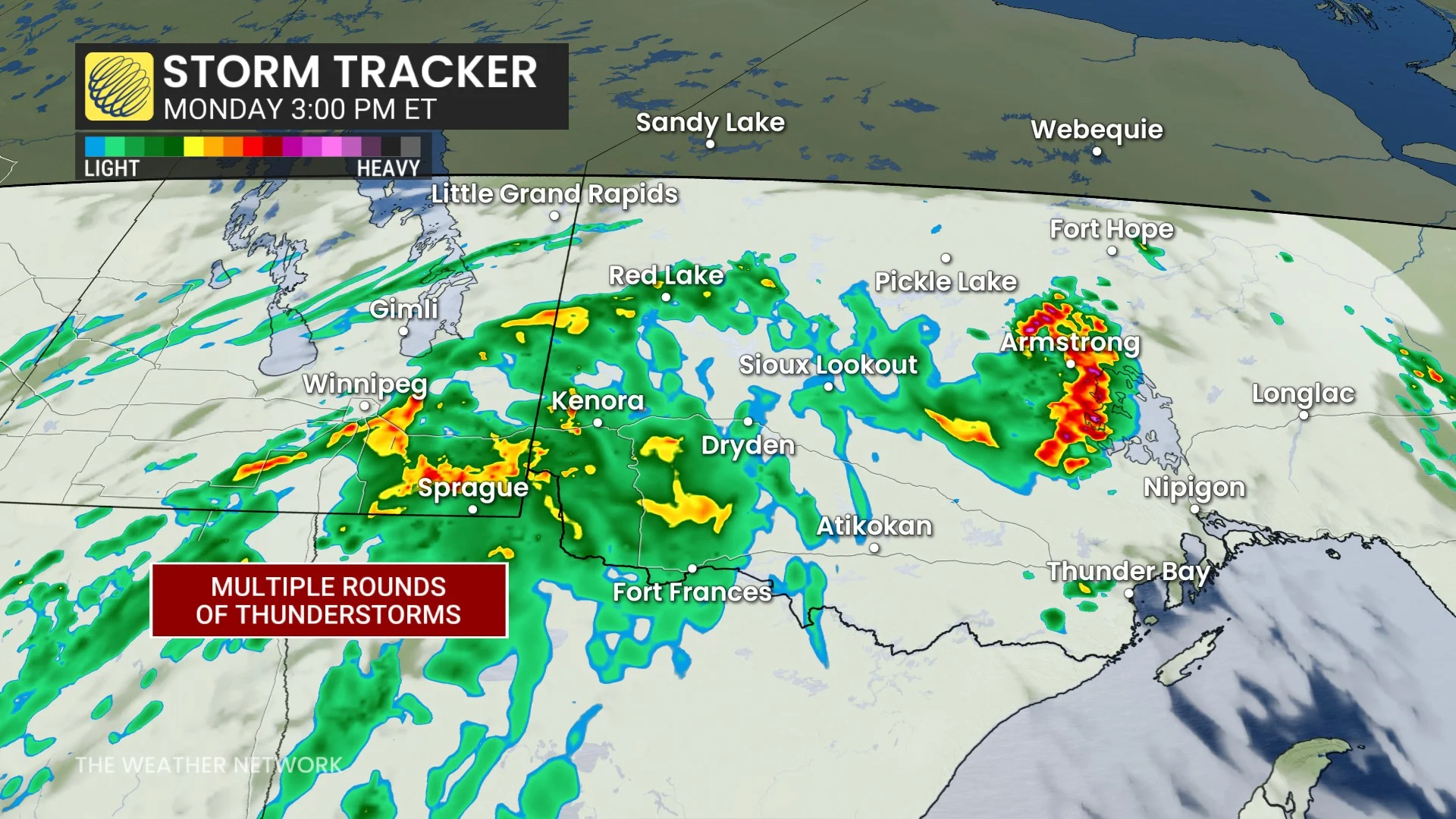
With strong, atmospheric dynamics in play, the ingredients will support severe thunderstorms Monday afternoon and evening.
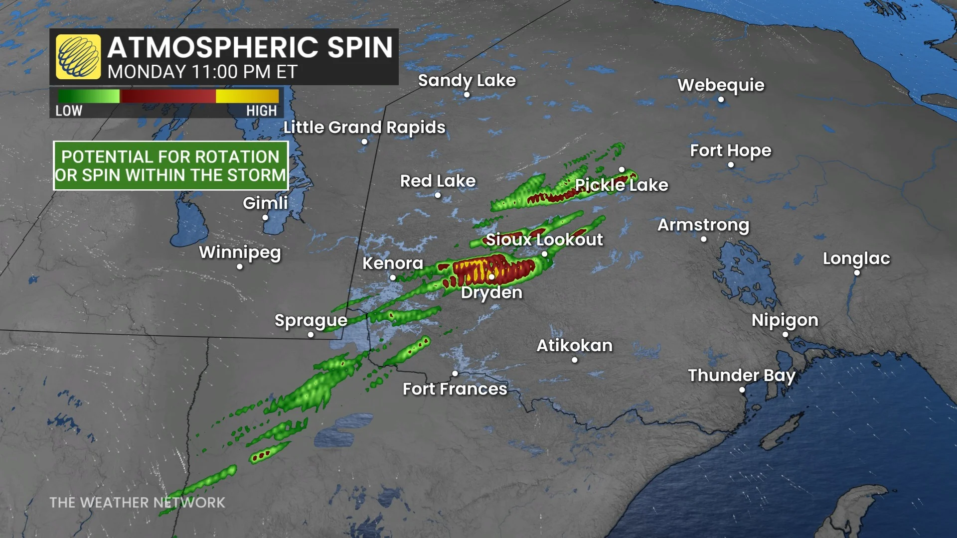
Possible impacts will include frequent lightning, torrential downpours, damaging wind gusts and large hail, as well as rotating storms capable of producing tornadoes, especially late Monday evening..
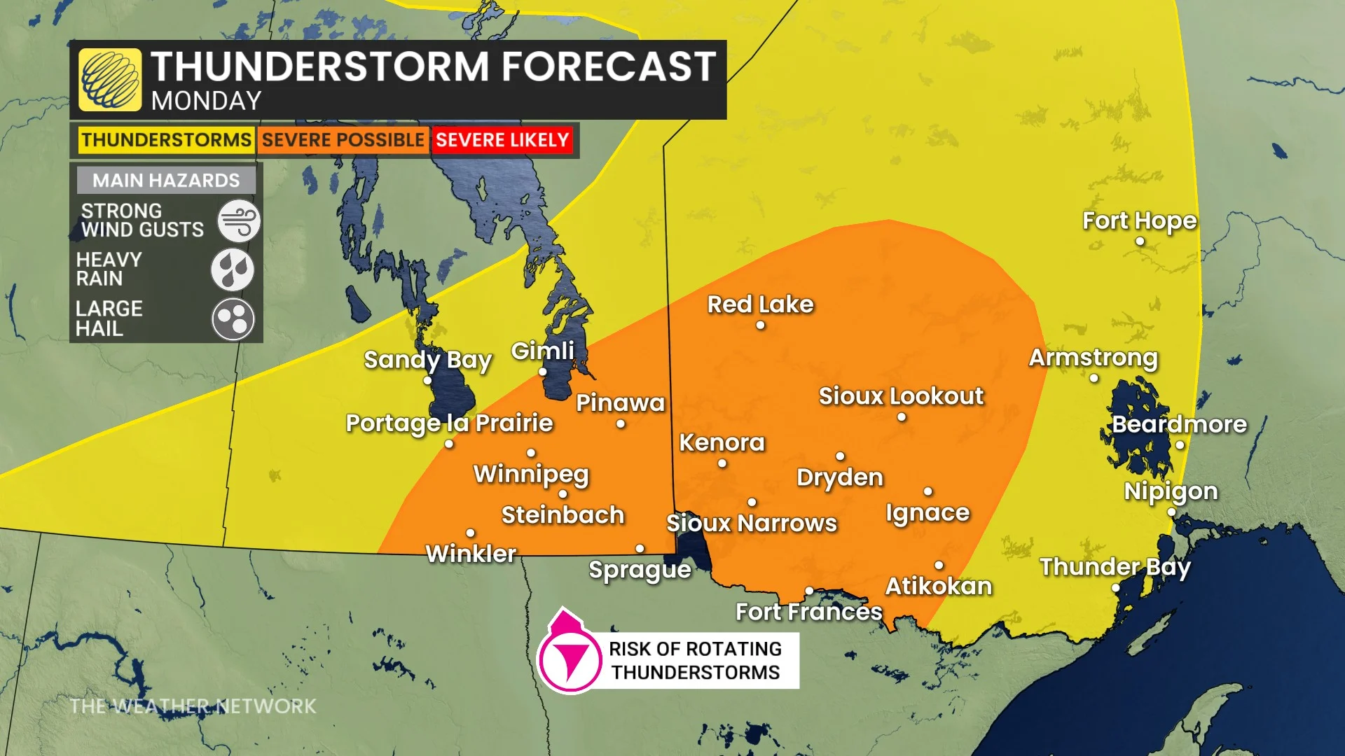
There is high confidence in the forecast of multiple rounds of thunderstorms with severe potential across northwestern Ontario.
The main uncertainty is which storms will become tornadic and where the highest tornado risk will be, but the northwestern Ontario region could be the target zone--stretching from the Lake of the Woods region through Kenora, and then Dryden to Fort Frances.
Stay with The Weather Network for the lates across Manitoba and Ontario