How will a strong El Niño impact lake-effect snow season?

The pattern could impact lake-effect snow, but don’t count out the season yet
Lake-effect snow is an iconic part of the cold season across parts of Canada.
Frigid winds blowing over warmer waters can lead to monumental snowfall totals that can take days to dig out.
But with El Niño in the driver’s seat this year, how will an altered pattern affect these bands of snow throughout the country?
WINTER SNEAK PEEK: El Niño puts record winter warmth in play
Bands of snow on lakes, seas, and straits
The Great Lakes are the quintessential snowfall producers for communities throughout Ontario. One solid event can bury communities in more than 100 centimetres of snow in a single sitting.
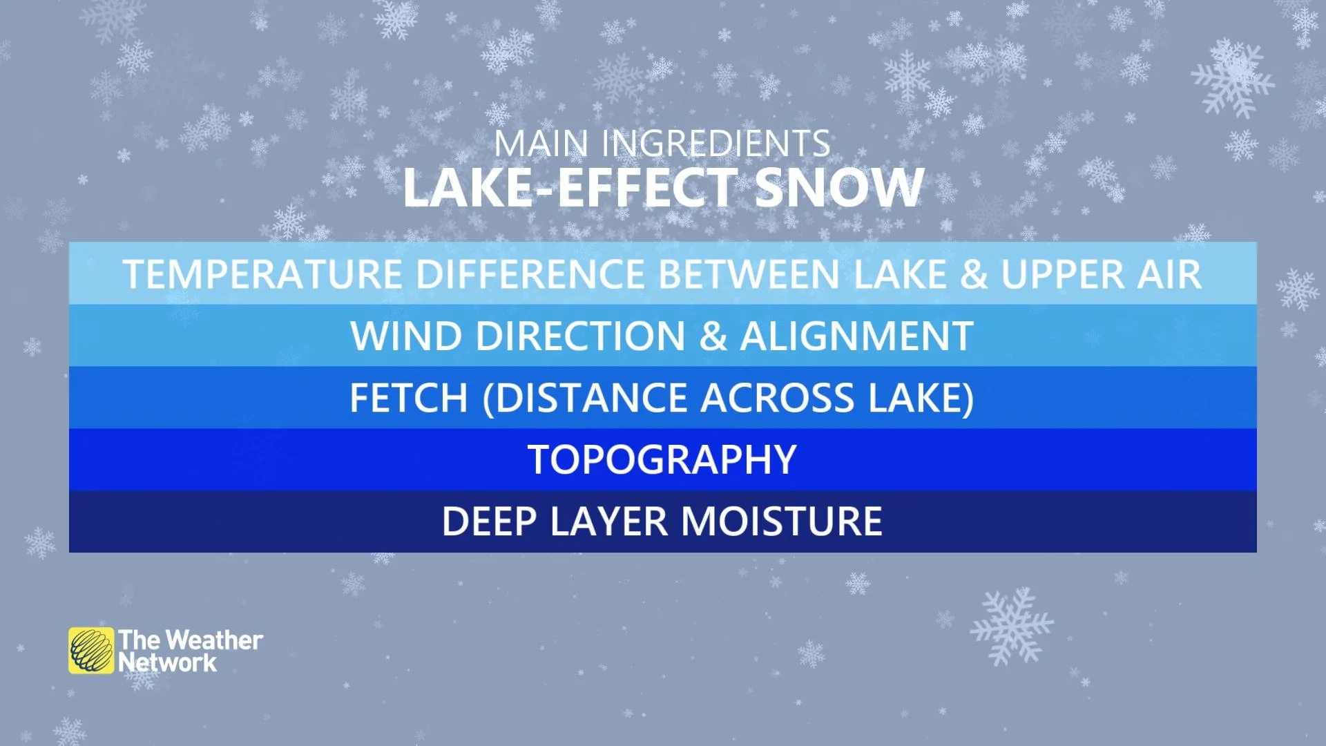
This process requires cold winds blowing over relatively warm and open bodies of water. Moist air heated by the water rises through convection, triggering organized snow showers that blow downwind. A feedback loop can sustain heavy snowfall for hours or days at a time.
Ontario doesn’t hold a monopoly on this kind of setup. Lake-effect snow is also common in southern Manitoba. Bands of sea-effect snow often blanket coastal areas in Atlantic Canada. Arctic winds can even lead to occasional strait-effect snow in southwestern British Columbia.
El Niño in charge heading into this winter
A strong El Niño tends to favour above-average wintertime temperatures across most of Canada.
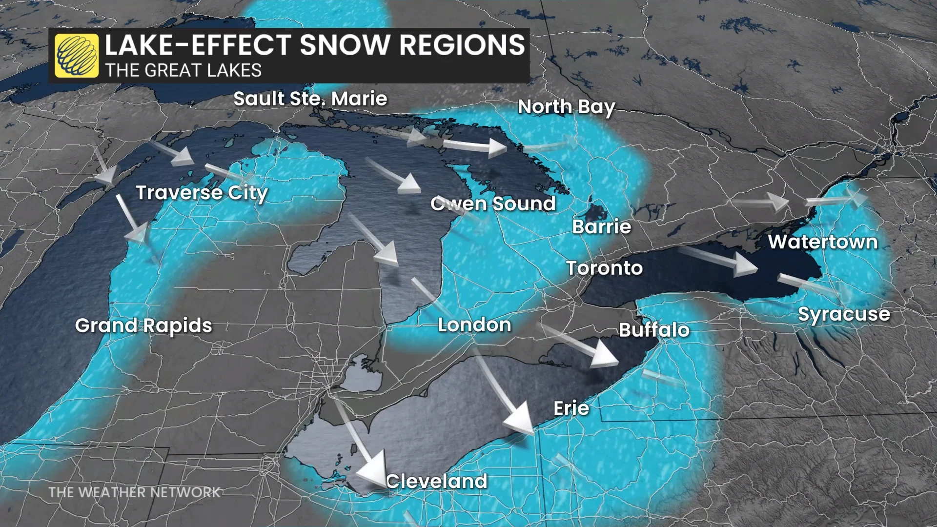
Based on this trend, we can generally expect less lake-effect snow this season as we’ll see fewer opportunities for outbreaks of Arctic air spilling southward.
Fewer opportunities doesn’t mean a snow-free winter, of course. Communities in and around the snowbelts will certainly deal with their fair share of lake-effect snow this season.
A favourable setup could even provide a couple of wallops in the months ahead. Given the expected above-seasonal trends, the lakes will remain open and warmer-than-normal for much of the season. One solid outbreak of frigid air rushing over those warm lakes could unleash quite the snowfall.
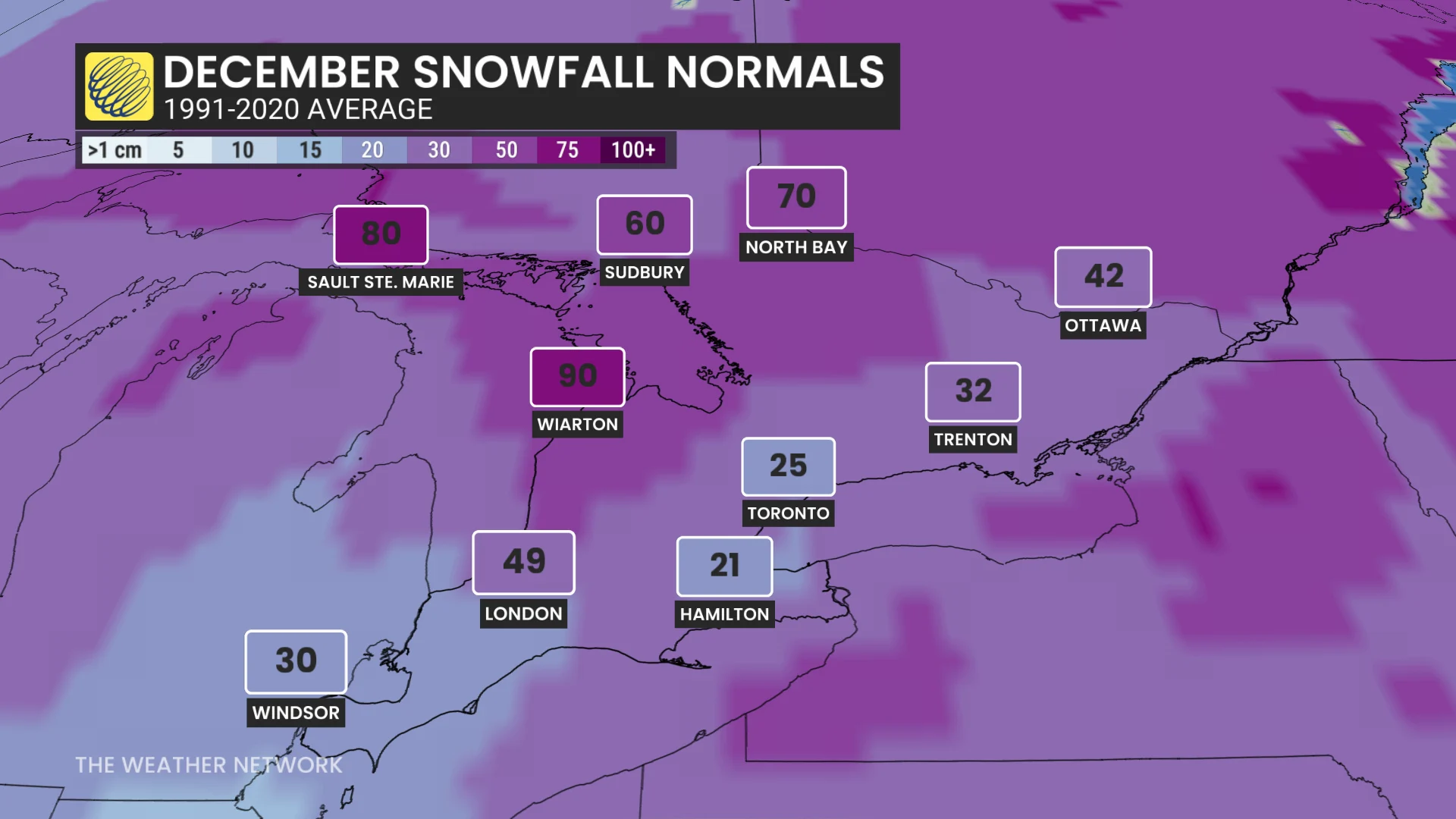
Overall, though, the trend toward a warmer-than-normal winter could leave many areas falling short of their seasonal averages. But keep in mind that it’s all relative.
Wiarton, for instance, averages 350+ cm of snow during a typical season. A total of 300 cm would represent a below-average season--but that’s still a hefty amount of shovelling throughout the winter months.